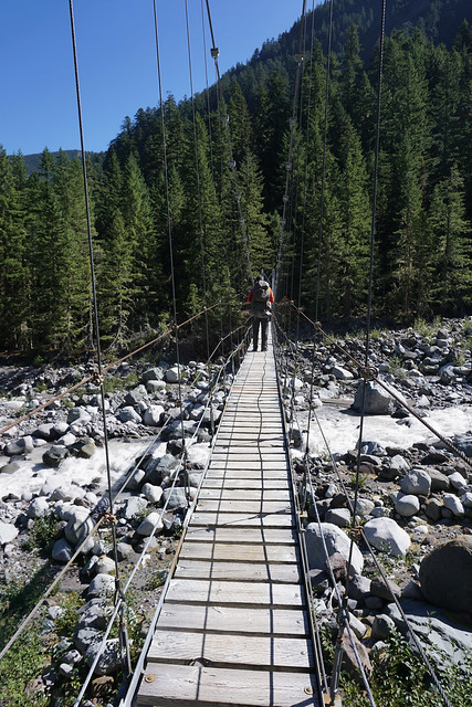
Our next day's hiking was determined primarily by available camp sites. Instead of a reasonable, read easy, route we took a detour up part of the trail named the Northern Loop. The total mileage wasn't all that bad but there was a small matter of a hill to go up. After departing camp, we crossed the Carbon River on a suspension bridge. How they ever got this built in the wilderness I don't know--I guessed dropping metal parts from a helicopter--but maybe it was better than having to build a new bridge after every spring flood. In fact, farther downstream, the trail had to take a detour after it was washed out in a flood a few years ago. The bridge doesn't look too intimidating until you get on it. Looking down at rock and glacier-fed river from a swaying platform that was missing a few wooden slats is scarier than it looked. There is a warning for only one person to be on the bridge at a time. I wasn't off yet when the next person started across and I can tell you the bridge started jumping and swaying a bit.
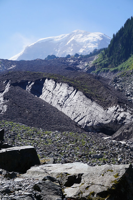
That safely past, we took a short detour toward Carbon River Glacier. Wikipedia tells me the glacier ends at 3500 feet of elevation and is the lowest glacier in the 48 states. It is also the largest outside of Alaska by most methods of counting. Like most glaciers the world over, it too is receding faster than a middle-aged man's hairline. I didn't hike to the glacier itself--there was a sign warning us not to since no one needs to be beaned by falling rocks or fall in a river. More honestly, I was saving my energy for the rest of the day's hiking. My son and I parted for a couple of hours so he could hike up the trail a bit and I could plod along toward camp. By the way, the gray stuff below the mountain is the glacier. No pearly whites at the tail end of a living glacier.
One advantage to hiking alone is that I could stop a bit more often, as often as my energy would allow, for photos. My enthusiasm for photography certainly waned as I encountered the one and only hill of the day. After going nearly entirely downhill for a few miles, we hit the turn off to our campsite. To get from the Carbon River to Yellowstone Cliffs was a mere couple of miles. All those miles were uphill. I didn't count on the way up, but on the way back down the next day (an exercise in frustration--who wants to hike up a mountain merely to hike down it again the next day?) I counted 21 switchbacks. Ugh. Trails like these made me grateful for the three meals we had already eaten since starting out.
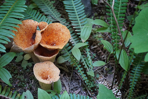
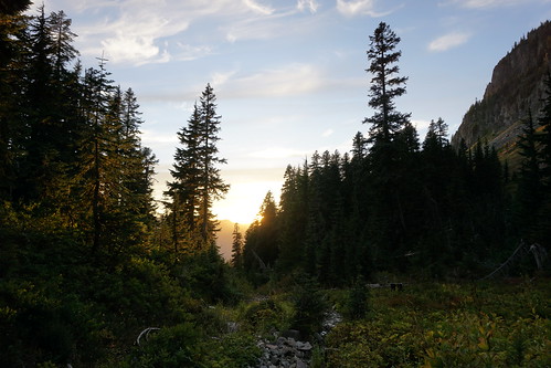
Most of the trail was heavily wooded. No views, a few pretty wildflowers and some interesting mushrooms and a small snake were the highlights of the trek until I finally could shed my pack.
We were the second party in a two site campground when a large party of older men moved in. No, they didn't have a reservation but they were tapped out and could go no farther. They were nice guys and some of them were significantly older than me (and I felt ancient at times on the trail). We weren't the campground police so we were happy to share our patch of trees and swap tales for a moment. I was amused when several of them set up camp right underneath the bear pole (used to suspend all our communal food to keep the bears out). It was some small consolation that if bears visited our camp, they'd know it first and alert us. The other campers where a father-daughter pair (she was in her 30's) which mirrored our mother-son pair nicely.
Stats for the day: 23,380 steps, 9.60 miles, 184 floor-equivalents. Hike beginning and end points are approximations.


3 comments:
Wow, that bridge looks intimidating enough, even in a photo. You are brave, but well worth
the effort I am sure. My husband once worked in Washington State briefly,but I think he mainly saw every golf course in the state.
Thanks for your comment.
Looks like a lovely place to hike, but I wouldn't be happy on that bridge!
The beautiful and severe nature..
Have a nice day
J.N.
http://jozzin.blogspot.com
Post a Comment