Wednesday, September 30, 2015

Busy!

Clouds and half a moon

I got bogged down in the usual things--work, television, too many Solitaire games on-line and haven't finished up my backpacking tale.  What is new is that I am taking an on-line creative writing class which is giving me a fair bit of homework.  I haven't had to do homework in quite a few years although I do have to do continuing education, take occasional exams for licensure and bring work home.  Somehow homework feels different.  I may get around to sharing some of the assignments here, or maybe not.

Crescent Moon

This week's highlight had to have been the eclipse of the moon on Sunday night so I am digressing from backpacking to post a few pictures.  I didn't expect it to me much of an event and thought I'd be one of the eccentric few going to the lake to view it, and was surprised by the feel of community out there.  The numbers were nearly comparable to the local crowd out viewing the (fairly distant) Fourth of July fireworks.

Bloody Moon

We were fortunate to catch a break in the clouds for the first half of the show and the clouds closed on us around the time the moon should have been peeking out again which made a good excuse to go home and not stay out too late.  It was a wonderful experience, sadly not soon to be experienced.   As far as celestial events go, next August 9-13 should be the peak of the Perseid meteor shower.  I should make a plan to find a dark mountain somewhere to watch that one.

Thursday, September 17, 2015

Rainier Hike, Day 3

Backpacking is hard work but life on the trail is, in some other ways, so simple.  You get up at dawn, go to sleep at dark.  You walk all day, then do a few chores, set up camp, filter water, cook dinner (which basically involves boiling water and stirring) and go to sleep.  Some nights sleep feels optional.  No matter how good the mat, the ground is always hard and the tent is always small.  Every time you turn, your mat crinkles, like sleeping on the waterproof mattress and pillow in a hospital. Each night spent in bear territory seems to involve some listening to the nightly noises outside.  Yes, the food might be hanging on a pole a few yards from the tent but who knows what a curious or hungry bear might decide to investigate?  The chapstick I forgot to hang?  Bits of dinner I spilled on my jacket?  My first night I found a cough drop in a pocket after I had crawled into my sleeping bag. Lazy me, I unzipped my tent and threw it as far as I could away from the me hoping a cute squirrel would dine on it.  Are there backpackers who don't develop a bit of a bear phobia?
Yellowstone Cliffs
Day three dawned chilly but sunny with a beautiful view of the Yellowstone Cliffs.  The night before I hadn't noticed the cave on the cliff side.  Maybe that was where the bears sleep when they aren't raiding camp sites.  Breakfast includes coffee thanks to Starbucks which makes a pretty good instant coffee and also an instant mocha that means I don't have to carry powdered milk.  After some oatmeal, we packed up and hit the trail, going in opposite directions. My son takes the high road, hiking further up the trail to see a few sights;  I head back down the hill again toward our next campground.  I don't move nearly as fast as he does and I was worried about my knees.
Some 30 years ago I backpacked on Isle Royale, my last major hike until a few years ago, and developed some significant knee pain.  I wound up using a stick to lean on for the duration of that hike.  Unfortunately the same phenomenon reappeared a few years ago while day hiking.  The trigger seems to be downhill stretches and with some internet research I concluded that I have iliotibial band syndrome which is merely an inflamed tendon.  I had worried that I was looking at knee surgery but fortunately this seems less serious.  Less happily, it hurts a lot.  After two episodes of the problem in the past 5 years I decided that I will try to train a bit harder and see if that does the trick.  So I've been working on it with Pilates, stretching, walking up and down stairs with my backpack on, using hiking poles and wearing a funny looking knee stabilizer, and this past trip it seems to have worked.  Over 2000 feet of downhill walking with backpack and my knee was fine!
Trees and more trees
For quite a while it was trees and more trees.  The forest passed by with no view of a beginning or end.  To mark time there were those 21 or so switchbacks and not much else.  At least I knew the hill had a bottom as I had been there the day before.  They were only slightly less tedious on the way down than on the way up.  It was hard not to feel a slight sens of mourning losing all the elevation I had gained with so much effort just the day before.
A Zee in the Trail
Well, this post is getting long and I need to get moving.  Stay tuned for day 3-1/2.

Friday, September 11, 2015

Hiking Mount Rainier Day 2

Where to
 Our next day's hiking was determined primarily by available camp sites. Instead of a reasonable, read easy, route we took a detour up part of the trail named the Northern Loop. The total mileage wasn't all that bad but there was a small matter of a hill to go up. After departing camp, we crossed the Carbon River on a suspension bridge. How they ever got this built in the wilderness I don't know--I guessed dropping metal parts from a helicopter--but maybe it was better than having to build a new bridge after every spring flood. In fact, farther downstream, the trail had to take a detour after it was washed out in a flood a few years ago. The bridge doesn't look too intimidating until you get on it. Looking down at rock and glacier-fed river from a swaying platform that was missing a few wooden slats is scarier than it looked. There is a warning for only one person to be on the bridge at a time. I wasn't off yet when the next person started across and I can tell you the bridge started jumping and swaying a bit.
Sorta, Kinda, Scary Bridge
That safely past, we took a short detour toward Carbon River Glacier. Wikipedia tells me the glacier ends at 3500 feet of elevation and is the lowest glacier in the 48 states. It is also the largest outside of Alaska by most methods of counting. Like most glaciers the world over, it too is receding faster than a middle-aged man's hairline. I didn't hike to the glacier itself--there was a sign warning us not to since no one needs to be beaned by falling rocks or fall in a river. More honestly, I was saving my energy for the rest of the day's hiking. My son and I parted for a couple of hours so he could hike up the trail a bit and I could plod along toward camp. By the way, the gray stuff below the mountain is the glacier. No pearly whites at the tail end of a living glacier. Rainier and Carbon Glacier
One advantage to hiking alone is that I could stop a bit more often, as often as my energy would allow, for photos. My enthusiasm for photography certainly waned as I encountered the one and only hill of the day. After going nearly entirely downhill for a few miles, we hit the turn off to our campsite. To get from the Carbon River to Yellowstone Cliffs was a mere couple of miles. All those miles were uphill. I didn't count on the way up, but on the way back down the next day (an exercise in frustration--who wants to hike up a mountain merely to hike down it again the next day?) I counted 21 switchbacks. Ugh. Trails like these made me grateful for the three meals we had already eaten since starting out.
Most of the trail was heavily wooded. No views, a few pretty wildflowers and some interesting mushrooms and a small snake were the highlights of the trek until I finally could shed my pack. Cool Shrooms
We were the second party in a two site campground when a large party of older men moved in. No, they didn't have a reservation but they were tapped out and could go no farther. They were nice guys and some of them were significantly older than me (and I felt ancient at times on the trail). We weren't the campground police so we were happy to share our patch of trees and swap tales for a moment. I was amused when several of them set up camp right underneath the bear pole (used to suspend all our communal food to keep the bears out).  It was some small consolation that if bears visited our camp, they'd know it first and alert us. The other campers where a father-daughter pair (she was in her 30's) which mirrored our mother-son pair nicely.   Sunset at Yellowstone Cliffs
 Stats for the day: 23,380 steps, 9.60 miles, 184 floor-equivalents. Hike beginning and end points are approximations.

Wednesday, September 09, 2015

Empty nesting--the first month

The Mountain is Out When the going gets tough, the tough go. . . backpacking. To begin the story, in late August we dropped my younger son off at college somewhere in Washington State (that is his story to tell, not mine ). As I was in dire fear of returning to an empty house, no offense to my husband, two cats, uncounted fish and two turtles (but they live outside in the summer), I immediately took off backpacking with my older son. Washington state was seemingly at risk of burning down due to some major forest fires and we had to dig a little deep to find a place to go that actually wasn't burning, wasn't lost in lung-crippling haze and made sense for a three night hike. We came up with Mount Rainier National Park which is an amazing place by any standard. It was, however, a choice with complications, since backcountry permits are hard to come by and require advance reservation or showing up at a ranger station first come-first served. The latter plan worked for us although getting to the station by 8:30 AM was challenging for my son who likes to sleep in. Finding available camp sites was a bit hit or miss. In fact after we picked our itinerary, with me stating over and over--I can't hike 10 miles in one day--we lost a site as the ranger was filling in our information. The itinerary we picked was challenging, in fact a bit more challenging than I realized as there was far more elevation loss and gain each day than I anticipated. I don't hike quickly and at 54 my knees aren't great but I try hard. On the Mountain 
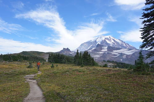
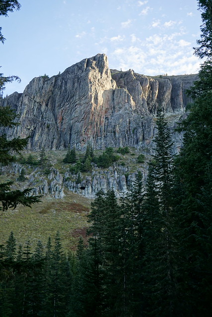
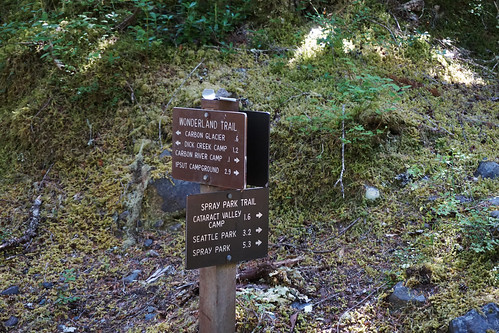
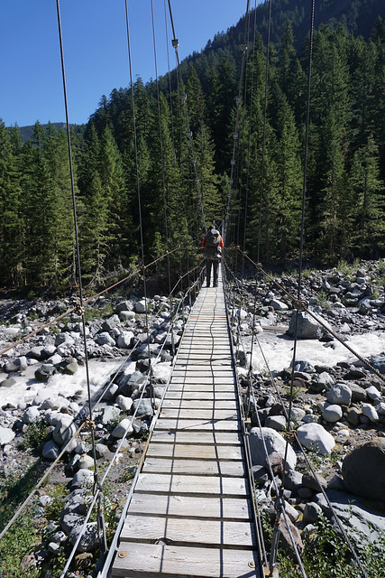
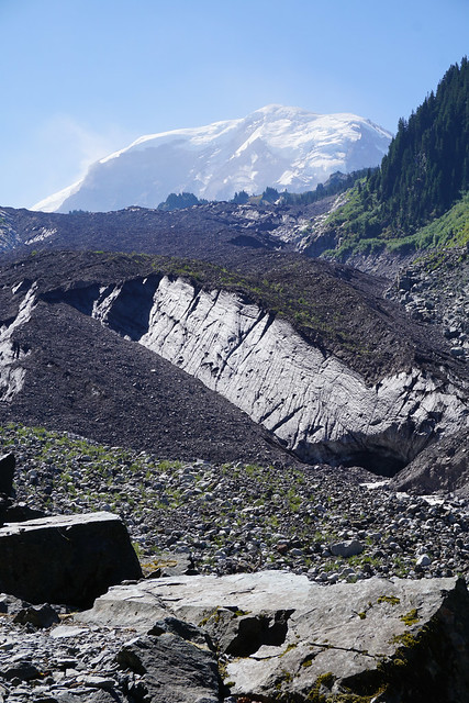
Our first day we hiked from Mowich Lake through Spray Park to Cataract Campground. When planning this trip we didn't realize we were hiking over a relatively high pass. Mowich Lake is at a reasonable 4929 feet and our first campground was at a similar elevation. The bad news is that we had to gain 2500 feet in elevation and then lose about the same. So much for my knees! In hindsight, I also carried too much water, and of course all our food that first day. Certainly, at times fatigue hampered my enjoyment of the view and there were moments I worried we wouldn't make camp before dark. View from the Trail 
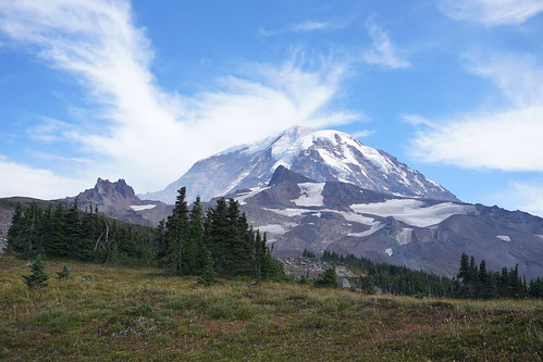
Seeing Spray Park again was a memory-laden milestone. We hiked there when I was a child and it is a place I will always love. However, back in the day, the wilderness was less populated and the rules were laxer or non-existent. We were able to camp in Spray Park and wander at will, checking out the flowers and small ponds that are everywhere early in the season. Now you are prohibited from leaving the trail due to risk of damage to the fragile meadows and there is no camping in the meadow area. Looking Back 
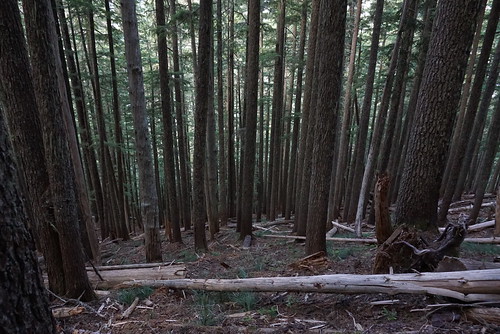
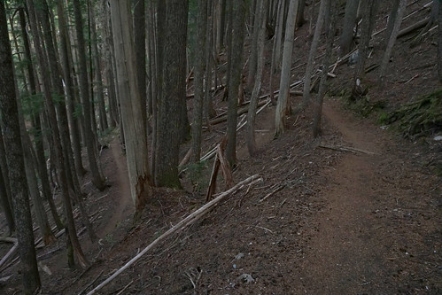
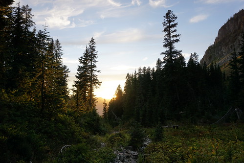
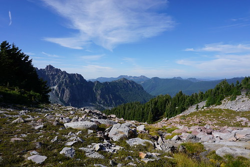
So we raced through, scoped out the views (which are amazing), huffed and puffed our way up a ridge and then down again to Cataract Campground. After Spray Park there were very few hikers on the trail and we largely had the place to ourselves. I lumbered or stumbled in to Cataract at around 7 PM with plenty of light to spare and we set up camp. There was only one other party there, a group of women around my age who seemed to have some sort of backpacking reunion going. We commiserated about the toilets (nastiest I have ever seen and an advertisement for holding it for a few days), they shared some excess food with us and we got camp set up, ate and slept. The camp was heavily wooded, no views to be had but quiet except for a snoring neighbor--sigh, isn't that why you go to the woods, to get away from all that?--but it was home for a night. I sure miss campfires! Getting up in the morning and boiling water over a camp stove is not as nice a way to beat off the morning chill.
I end day 1 with my Fitbit stats: 25141 steps, 10.33 miles and the equivalent of 200 floors of stairs (which is equal to 2000 feet elevation gain)--I would quibble with the stats in that, by the map, I did a bit more elevation and a bit less in total miles--I'd bet my stride length goes down with a backpack and difficult terrain. Nonetheless, my good intentions of walking less than 10 miles on relatively easy terrain didn't quite make it. Fortunately, I did, make it that is. Day two to follow or check out more photos on Flickr.

Monday, September 07, 2015